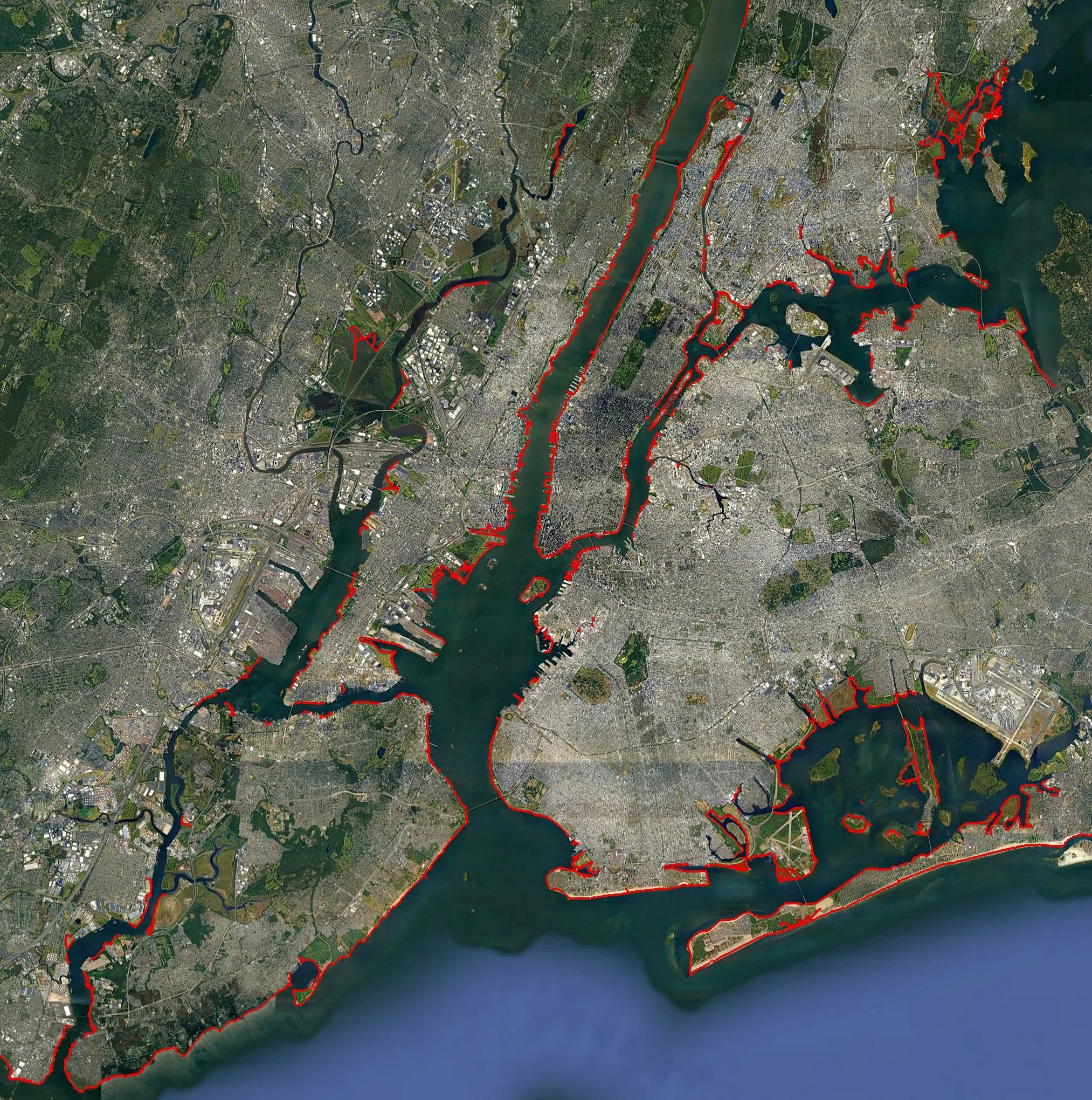
‘The Dido Project; Body as Stylus’
The Dido Project is an offshoot of an ongoing effort to explore, research and interpret the historic New York City metropolitan coastline. Since 2011, every excursion is recorded with GPS tracking devices, using my own moving body as a stylus to ‘draw’ lines on the surface of this area of the planet (ie; satellite maps). Tracks are uploaded to Google Earth appearing as red lines to generate an ever expanding imaginary circumscription of the city’s current landmasses- far different from those of the precolonial era due to centuries of landfilling. The Oxhide Myth describes how the Phoenician Queen Dido acquired a great tract of land in Tunisia by deceiving the Berbers. In this real estate deal, she requested and was granted a tiny piece of land- the amount encompassed by the hide of an ox. But to the Berbers’ dismay the hide was cut into thin strips and joined together to encircle a vast hillside. In my own benign version of this legend I seek to encompass the entirety of the City- some 570 miles of coastline. Though more than 620 miles have been logged (including surrounding metropolitan areas and repeat excursions), there are many more to come.